User Defined Grid
The User Defined Grids can be based on an arrangement of objects of any object type available in GeoDict. User Defined Grids are always generated periodically.
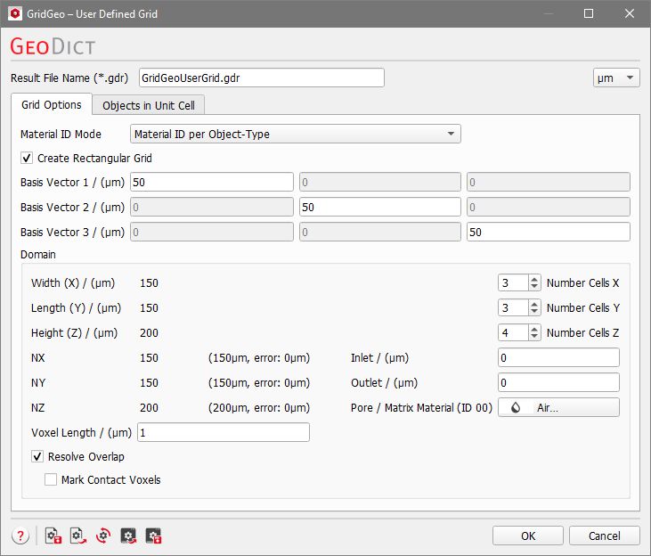
The GridGeo User Defined Grid Options dialog opens when clicking the Options’ Edit… button in the GridGeo section.
At the top left of the GridGeo User Defined Grid Options dialog, enter the name for the files containing the generation results in the Result File Name (*.gdr) box. Keep the default name, or choose a new name which fits to your current project.
The available units (m, cm, mm, µm, nm, and Inch) are selectable from the drop down menu at the top right of the GridGeo User Defined Grid Options dialog. When the units are changed, the entered values are adjusted automatically.